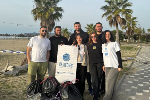


The Aerial Drone & AI Solution is a REMEDIES detection and monitoring technology that combines drone-based data capture with AI-driven image analysis to identify and monitor marine plastic litter in coastal areas. It is positioned for users who need reliable, scalable and less resource-intensive monitoring compared with conventional manual surveys.
Innovation snapshot
Related REMEDIES pillar: Detection & Monitoring
Partner(s)/Owner(s): Mohammed Premier University
Made for: Government agencies, local authorities, marinas, researchers, NGOs and industry users
Technology maturity: Patented technology developed within REMEDIES, with the development goal to advance from TRL 5 to TRL 8 by the end of 2026
Commercial relevance: Designed for organisations that need faster, more scalable and more precise coastal plastic litter detection and monitoring, with actionable outputs for clean-up planning, reporting and decision-making
Watch the Detection and Monitoring technology presentation:
The challenge it addresses
Marine litter monitoring often depends on manual surveys and visual observations. These methods can be time-consuming, labour-intensive and difficult to scale across extensive or hard-to-access coastal areas.
Plastic pollution is also dynamic. Currents, tides, weather conditions, seasonal use of beaches and human activity can change where litter accumulates. Without regular monitoring, authorities and organisations may lack the evidence needed to identify hotspots, prioritise action and assess whether interventions are working.
The solution is particularly relevant for wild beaches and areas with poor accessibility, where technology can reduce operational barriers and provide structured visual evidence.
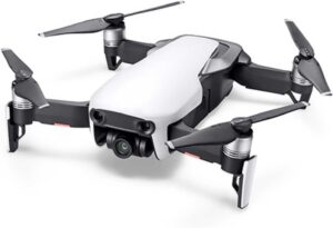
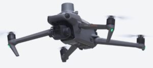
DJI Mavic Air and DJI Mavic 3 Enterprise drones used for aerial monitoring.
The solution
The solution uses drones equipped with high-resolution cameras to capture images and videos over coastal monitoring areas. These data are analysed through AI, especially deep learning algorithms, to detect plastic debris and support classification. The aim is to reduce the time and resources needed for field monitoring while improving the speed and precision of the insights produced.
The system supports rapid data acquisition over large areas, high-resolution imaging, AI-supported detection, dynamic pollution mapping and evidence-based clean-up planning. It is designed to help users move from observation to targeted action: detecting litter, understanding where it accumulates, and using the results for operational response, reporting and prevention strategies.
Operational structure: from drone flight to monitoring output
The field workflow follows a clear sequence: define the monitoring area, prepare the drone and flight plan, capture video or image data, process the data with the AI model, validate the detected results against field observations and use the outputs for maps, reports and decision-making.
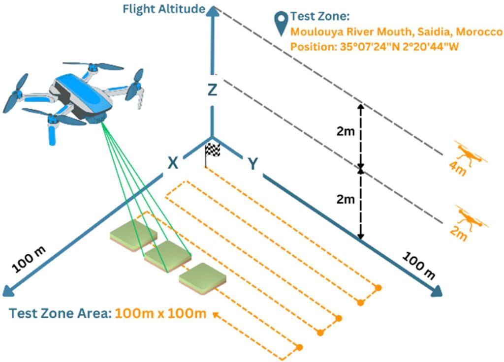 Drone monitoring test zone, flight altitude and zigzag path
The protocol specifies Saïdia Beach, in the site of biological and ecological interest Moulouya in Eastern Morocco, as the study area. The exact location is given as 35.123401, -2.347291. The monitoring approach includes seasonal surveys, with flight execution depending on suitable weather and safe wind conditions.
Field protocol and monitoring parameters
The monitoring protocol currently uses either a DJI Mavic Air or a DJI Mavic 3 Enterprise drone for aerial surveys. Although the protocol describes the technical specifications of the DJI Mavic Air (1/2.3-inch CMOS sensor, 12 MP image resolution, 4K video recording, and up to 21 minutes of flight time under optimal conditions), field monitoring is currently conducted using either of these two drone models, depending on operational requirements.
- Pilot and flight planning software: DJI GO 4, used for flight control, camera settings, intelligent flight modes and flight data.
- Flight altitude: 2 m.
- Flight speed: 1 m/s, with further study planned to identify the optimum speed.
- Image overlap: 20% image overlap for complete coverage.
- Flight path: Zigzag path with 1 m step to cover the monitoring area.
- Monitoring zone: 100 x 28 m in the protocol example.
- Operational note: At 1 m/s, covering the 100 x 28 m zone takes almost 47 minutes. The protocol states that 3 batteries are used for this slowest and most precise mode.
Wind condition: The protocol recommends maximum wind speed of 5 m/s, while also noting a maximum wind speed for flight of 10 m/s.
AI model and data analysis
The AI model described in the protocol is designed to detect plastic debris in general. The first improvement foreseen is counting the number of detected debris items. A second improvement is underway to identify several plastic types, including bottle, cap, goblet and bag.
The protocol refers to Label Studio as the open-source data labelling tool used to support model training. It also reports the following performance indicators for the image analysis model: mAP@0.5 = 77.03%, mAP@0.95 = 68.17%, Precision = 71.47%, Recall = 78.09% and F1 score = 74.63%.
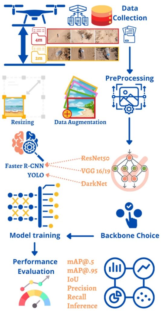 AI image analysis workflow from data collection to model evaluation
Flight height affects detection quality. The protocol includes a comparative example showing plastic detections at 4 m and 2 m flight altitude, supporting the need to define flight parameters carefully before operational use.
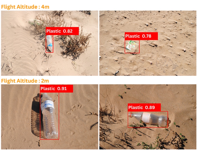 Detection examples showing how height influences detection accuracy
Data collection, processing and outputs
Before each flight, the protocol requires drone inspection, battery inspection, remote controller inspection, camera and gimbal checks, verification of DJI GO 4 settings and a short test flight in a safe and open area.
During the flight, the drone follows the flight plan to cover the monitoring area. The protocol foresees real-time control via a laptop screen, while noting that model performance is less reliable in real time because of high computational resource requirements.
The operational approach therefore relies on recording videos of the monitoring area and processing them asynchronously on a more powerful server. According to the protocol, the UMP technical team processes the video within 24 to 72 hours and produces an output video with detected plastic waste boxes. Later phases are expected to add counts and classes to the processed video output.
The results can be used to create maps showing the spatial distribution of plastic debris and to analyse spatio-temporal trends. Reporting outputs should include maps, graphs and statistics, and can be shared with local authorities, local communities and through scientific publications or presentations.
Field validation and Saïdia Demo Site context
The Aerial Drone & AI Solution has been tested in the Saïdia Demo Site in Morocco. The Saïdia context is useful for presenting the technology not only as a research prototype, but as a field-tested monitoring pathway for areas where plastic litter detection, regular monitoring and clean-up planning require stronger evidence.
Video – REMEDIES Saidia Demo Site:
Updates on the Saidia REMEDIES Demo Site: Tackling Plastic Pollution with Innovation (July 2025)
Unique value proposition
- Rapid, large-scale coverage: drones can scan extensive coastal areas faster than manual inspection.
- High-resolution imaging: visual data provides stronger evidence for detection, validation and reporting.
- AI-supported analysis: deep learning enables faster identification and classification of plastic litter in coastal areas.
- Reduced dependence on manual resources: the solution can lower the time and labour needed for monitoring campaigns.
- Dynamic pollution mapping: repeated monitoring can help identify hotspots, seasonal changes and changes in litter distribution over time.
- Protocol-based deployment: the field protocol gives users a structured approach for flight preparation, monitoring execution, data processing, reporting and safety.
Who can use it
- Government agencies and local authorities: Evidence for monitoring, clean-up planning, regulation and public reporting.
- Marinas and coastal site managers: Practical detection and monitoring of plastic litter accumulation in operational coastal areas.
- Researchers and universities: Structured data collection for marine litter studies, trend analysis and model validation.
- Environmental NGOs: Better evidence for awareness campaigns, community action and targeted clean-ups.
- Industry users and sponsors: A scalable sustainability solution with market relevance for coastal waste management and monitoring services.
Deployment and exploitation pathway
- R&D projects: continued development through collaborative research and field pilots.
- Operational readiness: target advancement to TRL 8 by the end of 2026, indicating a tested and validated solution ready for real-world deployment.
- Partnership opportunities: collaboration with public authorities, researchers, NGOs, advocacy groups, marinas and industry users.
- Expansion into new markets: replication in regions and sectors where automated marine litter monitoring is needed.
- Commercial positioning: a patented monitoring technology for organisations seeking efficient coastal waste management tools aligned with sustainability and policy objectives.
Protocol for beach plastic monitoring using aerial drones
A dedicated field protocol is available to support practical use of the Aerial Drone & AI Solution. It explains the monitoring objectives, drone and software requirements, study area setup, flight plan, pre-flight checks, data collection process, AI-based analysis, mapping, reporting, safety and ethical considerations. It can be added as a downloadable resource for teams that need a practical guide before using or replicating the technology in the field.
Download the Protocol for beach plastic monitoring using aerial drones here: https://remedies-for-ocean.eu/wp-content/uploads/2026/02/Protocol-for-beach-plastic-monitoring-using-aerial-drones.pdf
Discover more and contact
University Mohammed Premier: https://www.ump.ma
Contact for further information: info@remedies.com